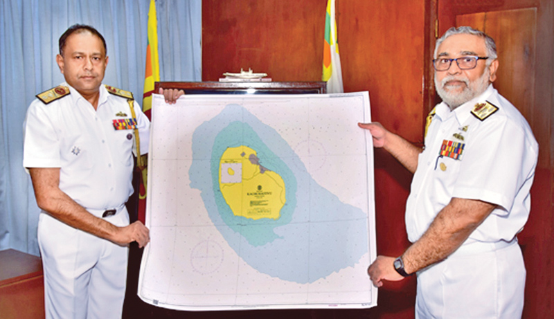
The first nautical chart prepared by the SLN Hydrographic Service (SLNHS) covering the Kachchaitivu Island was officially handed over to the Commander of the Navy, Vice Admiral Sirimevan Ranasinghe, by the Chief Hydrographer, Rear Admiral Sisira Jayakody, at the Naval Headquarters recently.
As Sri Lanka endeavours to become an important maritime hub in the region, development in the discipline of Hydrography is indeed an essential element for the country to prosper. Hydrography underpins almost every other activity associated with the sea, including safety of navigation, protection of the marine environment, national infrastructure development, coastal zone management, marine exploration, marine resource exploitation, maritime boundary delimitation, maritime defence and security and coastal disaster management, a spokesman for the navy said.
The mission of SLNHS is to meet defence, national and other stakeholder requirements providing navigational, hydrographic and geo-spatial information, products and services efficiently. its objectives are carefully set in to achieve the stipulated vision and specifically ensure that international obligations under SOLAS (Safety of Life at Sea) convention are met, he added.
Add new comment